RER Maps
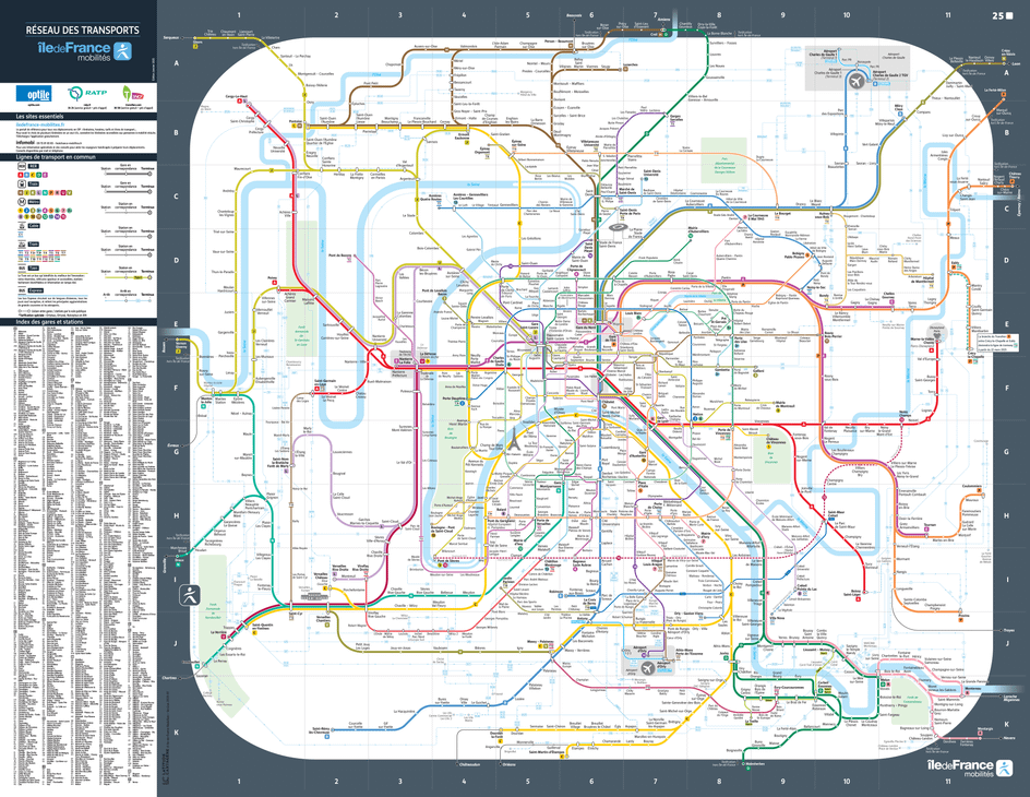
Organize your journey and easily get around Paris and the Île-de-France region with our Paris RER map, accessible with just one click. The « Réseau Express Régional », better known by its acronym RER, was established in the 1970s. The 5 RER lines cover 600 km of tracks and serve 249 stations in the Île-de-France region. The network welcomes 2.7 million passengers every day.
The RER allows you to cross Paris through an underground network and reach the terminus of the lines in the suburbs, on both sides of the capital. It is therefore possible to travel quickly throughout the region, from north to south, from east to west, and vice versa. The Paris RER map shows you the routes and stations served in Paris and the neighboring municipalities.
The entire Greater Paris metropolitan area is served by the RER. On the Paris RER map, you will find all the major accessible hubs in the inner and outer suburbs: the Paris Airports, Disneyland parks, the Palace of Versailles, and Massy Palaiseau station are all connected to the capital by the RER. To better navigate Paris and its suburbs, feel free to download the RER map in PDF format.
RER route map in Paris and Île-de-France
Click on the map to enlarge.
Check the map of your line and find the schedules

All public transports
Discover the public transportation network in Île-de-France: line maps, real-time traffic, and other practical information.Also download maps for: ⬇️ people with reduced mobility ⬇️ wheelchair users